By UDO IBUOT
Hope deferred maketh the heart sick: but when the desire cometh, it is a tree of life – Proverbs 13 v. 12
WHEN prolonged waiting for eagerly desired expectations is delayed, it is plausible to argue that disappointments, disillusionments, and loss of hope may result. On some occasions, such drawn-out processes can lead to afflictions or even sickness.
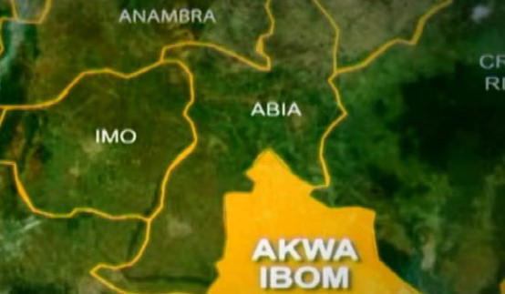
However, the antithesis of deferment, that “a fulfilled desire is a tree of life”, is indeed soothing to the soul because it has the potential to offer a final solution to any crisis. In the current scenario in Akwa Ibom State, the fulfillment represents a fundamental alignment with the issue in contention: that the Andonis, or Eastern Obolo, on the east of the Opobo (Imo) River, whether in the hinterland or on the Atlantic seaboard, are in temporary occupation of Ibibio patrimony.
The Ibibios (called the Kwa Ibos, Ibbibby, or Moko in pre-colonial and colonial times) are the aboriginal and legal owners of the territory situated between the Opobo (Imo) River and the Cross River. Talbot (1926) and Noah (1979) suggest that by 7,000 BC, the firm formation of most of the Ibibio ethnic groupings in the area had begun. Furthermore, they remark that the area, with its endowments of rich forests and rivers with fresh and saltwater resources, was capable of supporting a human population from very early times.
From the legal perspective, it is on record that the legal ownership of Ikot Abasi district by the Ibibios was decided at the Supreme Court of Nigeria on March 6, 1926, before their honours, Sir Ralph Molyneux Combe, Chief Justice of Nigeria; Sir Frederick Alan van der Meulen, Judge; and Mervin Lawrence Tew, Judge. In the ruling that was concurred in by all the justices, it was held that the Kwa Ibos (Ibibios) never exerted any ownership over land on the west side of the Opobo (Imo) River. The justices further held that the natural boundary of the Ibibios on the west would be the Opobo (Imo) River, and that “this river was in fact their effective boundary”.
Another challenge against the legal ownership of the Ibibios in the Ikot Abasi district was decided by His Lordship, Justice John Jackson, of the High Court of the Protectorate of Nigeria at Calabar, on February 21, 1945. In Suit No. C/21/1941, between Ntuenibok and others vs. Douglas MacJaja; later consolidated with suit No. C/8/1943, between Udom Nse and others vs. Matthew of Okoro Ete, the learned judge ruled as follows: “Where settlements of Andonis (later referred to as Eastern Obolo) have been made east of the Opobo (Imo) River, the uncontradicted evidence is that such occupation was conditional upon the payment by the Andonis to the Ibibios of hundreds of large fish each year.”
The learned judge further held that, though there may have been numerous settlements by the Andonis on the east side of the Opobo (Imo) River, such expansions did not negate the fact that they were living on Ibibio territory.
The Andonis approached the West African Court of Appeal, WACA, in Lagos. The suit marked WAC 2264 – C/21/1941, was before the learned Sir Walter Harrington, Chief Justice of the Gold Coast; Sir John Verity, Chief Justice of Nigeria; and John Alfred Lucie-Smith, Chief Justice of Sierra Leone, on May 5, 1947. The Lordships dismissed the appeal with costs assessed at fifty-one pounds and eighteen shillings.
A challenge over the legal ownership of the Ibibios of Eket district with the Ibenos was decided in 1916 following litigation between Ibok Etuk Akpan vs. Obongisong Edoho Eket and Ntiero. This was over the ownership of Stubbs Creek (Akoiyak) and later Okposo. The matter, which was decided at the high court in Calabar, was won by Eket, but Ibeno appealed against the judgment at the West African Court of Appeal, WACA, in Lagos. Following their subsequent loss, Ibeno subsequently appealed to the Privy Council in London in 1918 but still lost the appeal.
The Ibibios have never challenged the Andonis over ownership of the west bank of the Opobo (Imo) River, but several expansionist moves have been witnessed on the part of the Andonis (who now claim to have become Ijaws) against the Ibibios. Two local government councils: the Eastern Obolo and Ibeno, were created for the Andonis scattered in fishing ports throughout the Ikot Abasi, Mkpatenin, ONNA, and Eket districts. At the time of their creation, no official map was delineated and gazetted for local governments in the state.
But an Andoni commissioner under the administration of former Governor Victor Attah, allegedly caused a map to be drawn surreptitiously to expand the land mass of these local government areas. The Eastern Obolo attack that led to the murder of several citizens and the destruction of the Ikot Akpan Udo community in Ukpum Ete Clan, Ikot Abasi LGA, on August 28, 2008, was pegged on the initial claim by the Eastern Obolo LGA chairman, Francis Uduyork, that no boundaries have been delineated for the council.
Uduyork presented a paper to the judicial commission of enquiry on the disturbances that the attack on the Ikot Abasi community was induced by the lack of boundaries. If the former council chairman’s claim of a lack of boundaries is right, the questions that flow from it would be: why are the Andonis claiming that they had a map and describing the recent legislation by the State House of Assembly to officially delineate and gazette the mapping of the state as a “remapping” exercise?
And why are the Andonis embarking on fresh bloodletting and the destruction of rebuilt homes in the Ikot Akpan Udo conurbation? The former commissioner’s illegal map, which has been denounced by the former Governor, Obong Attah, apparently motivated protesters in Eastern Obolo, Ibeno, and Mbo council areas to approach a high court at Uyo to stop the enactment and gazetting of the Akwa Ibom State Map Establishment Law, by the state House of Assembly, but the action was struck out by the court.
The surveying and gazetting of an official map for Akwa Ibom State by the state’s Surveyor General is a welcome development. It is not only the needed panacea for peace in the state, but also an instrument that is bound to situate every clan within its existential boundary. As the paramount ruler of Eket, HRH Edidem Etim Abia, has said: “What was circulated in the past was not an official map; it was something someone drew and the people used it, and that map created a lot of problems.”
Edidem Abia’s position which reflects the views of the Ibibios, especially in the littoral districts, is worthy of commendation. Indeed, the newly gazetted official map for the state, which has come as a divine response, has the potential to end years of dispute between communities and enable every local government area to participate in and benefit from the exploitation of maritime and land resources that God has, in His infinite mercies, endowed for the mutual use of His people.
Former Governor, Udom Emmanuel, who assented to the bill last April, was initially opposed to the proposal following his alleged desire to leave the state the way he met it. However, his repentance and support for the official mapping and gazetting exercise have earned him a place in the pantheon of Akwa Abasi Ibom leaders.
With the enactment of the map establishment law, the state government now has the task of not only rebuilding the Ikot Akpan Udo community but also stationing the military to provide security for the citizens and check the excesses of the Andonis.
Dr. Ibuot, a journalist, wrote from Lagos.
Disclaimer
Comments expressed here do not reflect the opinions of Vanguard newspapers or any employee thereof.