By Ayo Onikoyi
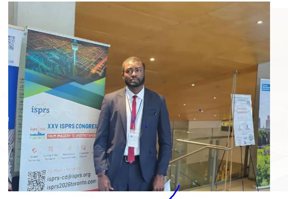
In an exclusive interview, a renowned scientist and scholar, Michael Ekwe highlighted the transformative impact of satellite remote sensing technology on modern agriculture in Nigeria. As a leading expert in crop monitoring, Ekwe emphasized how the deployment of satellite remote sensing products can revolutionize agricultural productivity in Nigeria.
Agriculture is the backbone of Nigeria’s economy, employing millions and providing food security for the nation. However, Ekwe emphasized that the sector faces numerous challenges, including herders-farmers clashes, low crop productivity, inefficient resource utilization, climate variability, and limited access to modern technologies. He explained, “traditional farming methods have proven insufficient in meeting the demands of Nigeria growing population, necessitating the adoption of innovative approaches.” In his opinion, “one of the most promising solutions is the integration of satellite remote sensing tools, which offer advanced techniques for monitoring and improving agricultural practices.” Ekwe stressed that by leveraging these technologies, Nigeria can enhance crop yield, optimize input usage, and promote sustainable agricultural development.
Remote sensing, particularly through drones and satellite imagery, provides real-time data on crop health, enabling precision agriculture. In his study, Ekwe identified that Sentinel-2 with high-resolution multispectral imaging capabilities, has proven valuable in assessing crop growth conditions and detecting plant stress. He also stressed the importance of combining remote sensing with machine learning models, which could help farmers and policymakers to make data-driven decisions that improve agricultural efficiency. He further noted that these technologies allow for early detection of stressed fields, enabling timely interventions such as targeted fertilizer application and irrigation adjustments. The findings of his research highlighted how satellite-derived data can accurately monitor groundnut overall health and growth patterns during the growing season, offering a cost-effective solution for farmers.
He stressed that one of the most significant advantages of remote sensing technology is its ability to monitor large agricultural landscapes with minimal manual effort. Traditional field surveys are destructive, labor-intensive and time-consuming, whereas satellite data (including drones and satellite images) can provide comprehensive insights across vast agricultural regions in near real-time.
Ekwe further highlighted the importance of estimating crop yield indicators such as leaf area Index, canopy chlorophyll content, and biomass, as these enable accurate crop yield predictions. He stressed that these indicators could assist farmers plan harvest schedules, allocate resources efficiently, predict crop yield, and mitigate potential losses due to unfavorable conditions.
Ekwe noted that collaborations between government agencies, research institutions, and private enterprises are essential in scaling satellite technological innovations and making them accessible to smallholder farmers. He concluded that, to fully realize the benefits of satellite remote sensing technology in Nigeria’s agriculture sector, investment in infrastructure, training, and policy development is necessary. He further stressed that the Federal Government of Nigeria under President Bola Ahmed Tinubu GCFR, should financially support the launching of high-resolution satellites that could support crop monitoring in the country. “By fostering a technology-driven agricultural sector, Nigeria can bridge the gap between traditional farming practices and modern innovations”, he added.
Disclaimer
Comments expressed here do not reflect the opinions of Vanguard newspapers or any employee thereof.