By Evelyn Usman
History is about to be made in Nigeria, following plans by the Nigerian Navy to replace the United Kingdom navigational chart that has been operational for hydrographic surveying activities in the country for decades, with its.
As first step to actualising this feat, the Navy, recently procured a hydrographic research vessel, NNS LANA which is expected among other functions, to ensure that the entire nation’s water had adequate chart coverage.
In a virtual address to Nigeria’s Hydrographic community during the 2021 World Hydrography Day, Monday, which also marked 100 years of international cooperation in hydrography, Chief of the Naval Staff, Vice Admiral Awwal Gambo, stated that through international cooperation in hydrography with the United Kingdom as far back as the 18th century, Nigeria had been able to keep its sea lanes of communication open for all forms of maritime activities that supported over 96 percent of the nation’s sea borne trade.
He disclosed that ” through the international cooperation and the Nigerian Navy’s engagement with other hydrographic industries players in Nigeria, like the Nigerian Ports Authority, NPA, Nigerian Maritime Administration and Safety Agency, NIMASSA , National Inland WaterWays Authorities, NIWA among others, Nigeria was able to produce its indigenous navigational charts and nautical publications in 2019.
This feat placed Nigeria on the international map of chart producing nations.
“Further international cooperation with India in 1975 and the International Hydrographic Organisation, IHO in 1976, helped Nigeria , particularly its Navy, to build human capacity in hydrography and develop standards for hydrographic and chatting.
“As you are aware there are two paper charts and three cells of electronic navigational charts indigenously produced by the Nigerian Navy which are currently supporting safety of navigation in the Nigeria waters.
“With the recent addition of the state of the art 60 meter hydrography survey vessel, NNS LANA, to the Nigeria Navy’s inventory, the stage is set for more international and national collaborations towards improving hydrographic service delivery to mariners within Nigeria waters.
Already, discussions are ongoing with the NIPPON foundation /GEBCO for Nigeria’s participation in the sea bed 2030 project, which is aimed at facilitating Nigeria’s fulfilment of the UN Sustainable development goal 14, which deals with the sustainable use of the ocean , sea and marine resources “
While noting that hydrographic applications had increasingly shifted from safety of navigation for marine transport to other activities that facilitate sustainable use of the ocean for economic growth such as offshore wind farming, coastal zone management , blue economy as well as offshore exploration and exploitation of mineral resources among others, the CNS said, “These activities therefore, require a great deal of national and international collaboration at various stages for maximum benefits to be derived .
“This is why I consider this year’s world hydrography day , which marks the 100 years of international cooperation of hydrography, as apt for Nigeria. This is particularly so, when the dwindling economic fortune of the world elucidates a rethink towards economic diversification in Nigeria, using hydrography as a critical enabler.
“Through hydrography, Nigeria’s inland water, which connects the Atlantic ocean via over 25 river entrances, can be open for transportation of goods and services from the hinterland to the sea for export towards enhancing Nigeria’s economy”.
Vice Admiral Gambo further explained that effective hydrographic practice would ensure adequate chart coverage of about 84,000 square nautical miles of Nigeria’s territorial water and ultimately provide up to date nautical products to drive Nigeria’s blue economy project, including support for safe conduct of mariners’ activities.
He therefore called for an increased cooperation among stakeholders in the field of hydrography, with the Nigerian Navy ,for faster survey and chart coverage of the nation’s waters towards facilitating robust maritime activity for security and economic growth of the nation.
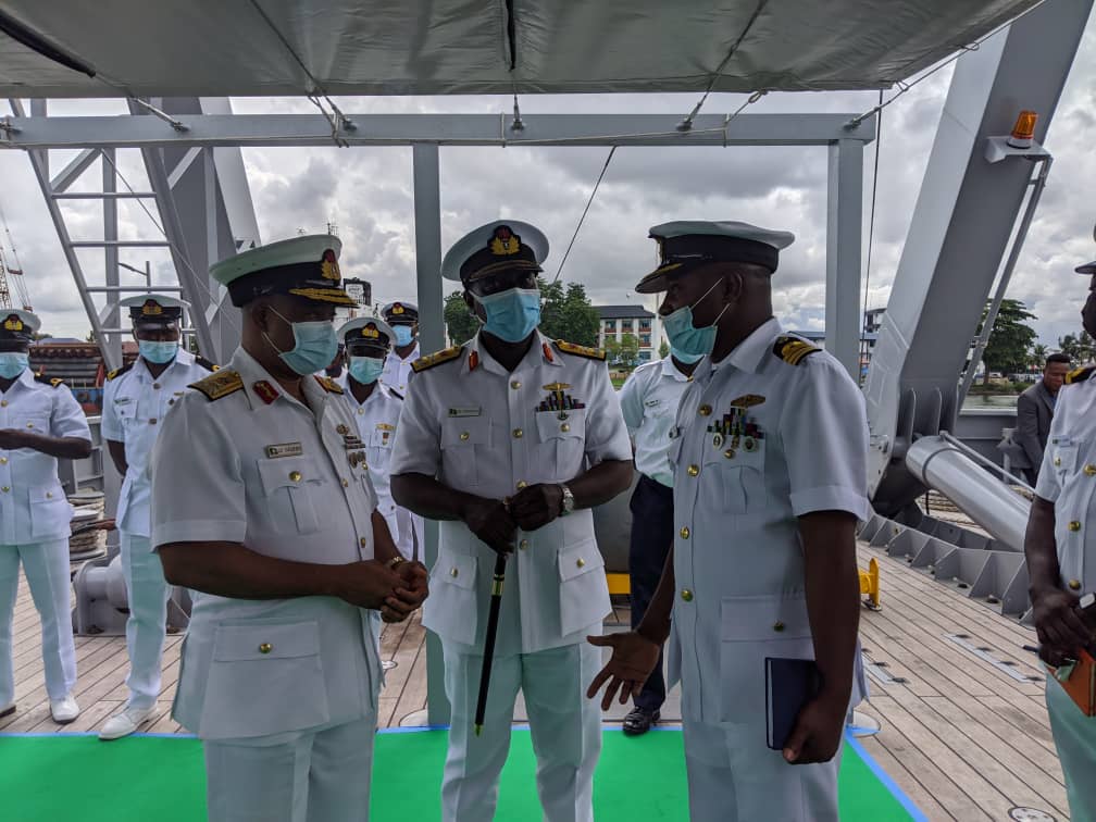
Addressing newsmen onboard NNS LANA, at the end of the virtual meeting, Hydrographer of the Navy, Rear Admiral Chukwuemeka Okafor, noted that with the acquisition of the hydrography vessel, part of the navy’s plan would be to ensure that the entire nation’s water was charted
When this is achieved, he said the navigational charts of the United Kingdom which had been used for hydrography in Nigeria would be faced out.
He said: ” every nation is responsible for charting its coastal and offshore water. UK was doing it because it was like a stop guard measure. We did not have the capacity that was why they did it. And now that we have the capacity, we will gradually take over from them and as a matter of fact, we have started.
“If you check the international chart catalogue now, you will discover that the Lagos harbour chart, part of which is where this vessel is standing, used to be a chart from the UK. But because we produced this chart , it has replaced the UK’s .
“The plan to ensure that the entire nation’s water is charted starts with the acquisition of NNS LANA. The charts were produced using a smaller boat that can operate within the inland water. Those boats were used to acquire the biometric data that was used to produce those charts. Because those boats cannot safely operate at the off shore areas, that’s why this vessel was acquired.
“And before this vessel arrived, the hydrographic office developed a national charting plan that shows how charts can be produced to cover all of Nigeria’s maritime space. One after the other, those plans will be implemented using this vessel.”.
He however explained that though NNS LANA is an auxiliary ship, he said it could also perform security and maintenance roles . “While at sea the ship can be rerolled to interdict and intercept any vessel that is engaged in illegality”.
Disclaimer
Comments expressed here do not reflect the opinions of Vanguard newspapers or any employee thereof.